After real-feel temps overnight at or below zero degrees, the sun returns Friday, but so too will the frigid temps, with the high in the low to mid 20s and real-feel temps in the single digits and, in areas farther north, below zero.
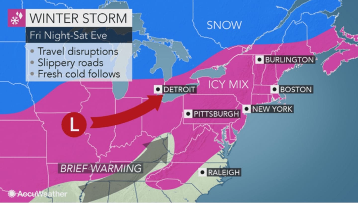
The storm system will bring snow and ice in the pre-dawn hours Saturday as motorists will have to contend with slippery travel from the northern mid-Atlantic states through the Hudson Valley and up into New England. Road conditions will range from snow-covered to slushy or wet, AccuWeather.com said.
"The snow can come down hard at first, which could quickly cover roads, highways and sidewalks in the major cities from the I-99 and I-81 corridors to the I-95 cities of Philadelphia, New York City and Boston with this storm," according to AccuWeather Senior Meteorologist Henry Margusity.
Areas south of I-287 in the Hudson Valley will see 1-2 inches of accumulation, with a changeover to rain at around 8 a.m. Saturday. North of I-287 should see between 1-3 inches with the changeover occurring late in the morning and Putnam and Dutchess 2-4 inches, with the changeover to rain happening around noon.
The temperature will climb to a high of around 40 on Saturday.
More rain is likely Sunday with a high in the mid 40s.
Check back to Daily Voice for updates.
Click here to follow Daily Voice Tarrytown-SleepyHollow and receive free news updates.